The Mystery of the Vinland Map
When the Vinland Map first emerged in the mid-twentieth century, it carried a promise so disruptive that it immediately set historians on edge. If genuine, this modest-looking parchment would redraw the story of European exploration. It appeared to show part of North America, labelled as Vinland, centuries before Christopher Columbus ever sailed west. Not hinted at, not speculated about, but mapped.
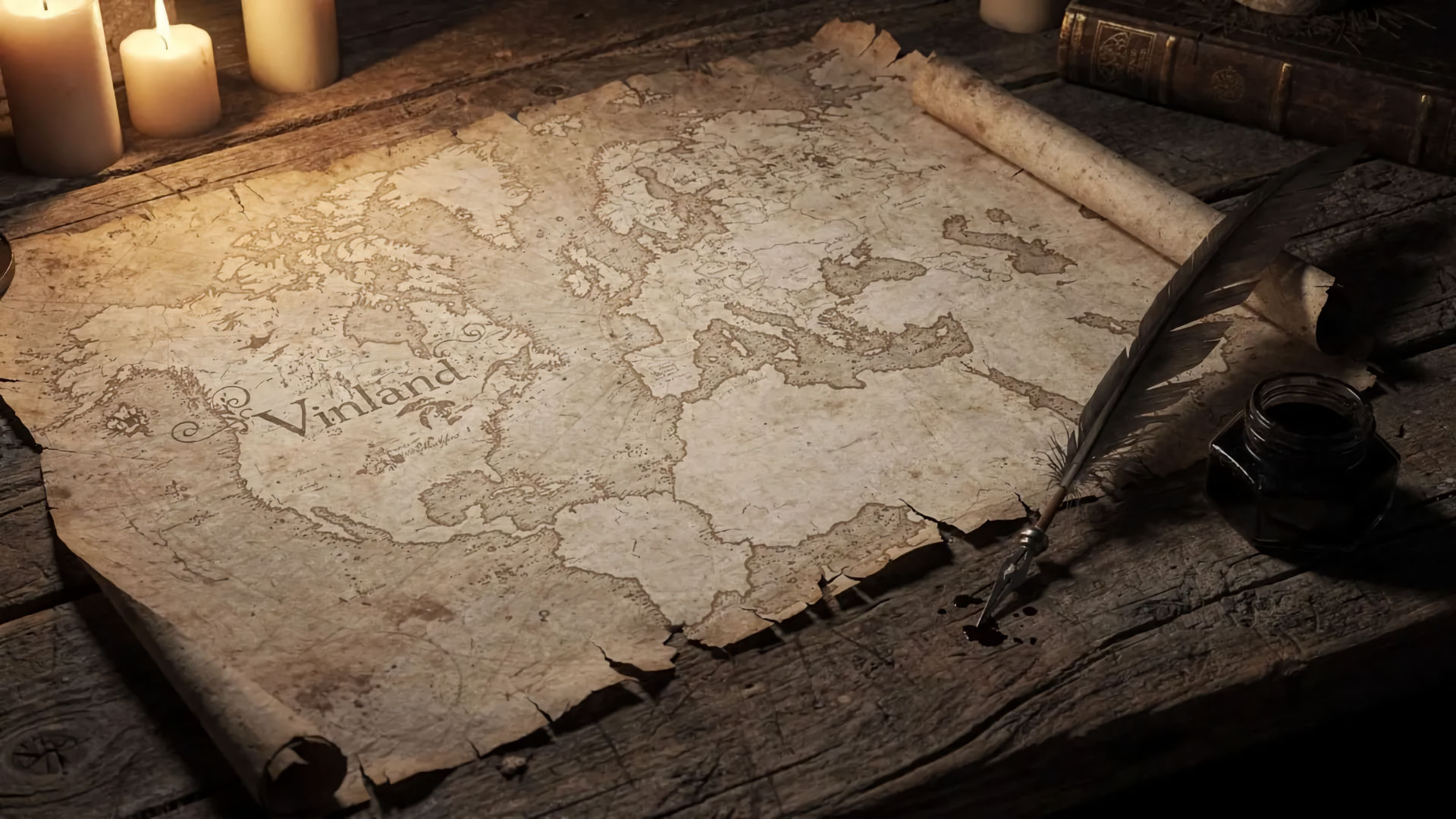
At first glance, the map seems unremarkable. Its style resembles other medieval world maps, showing Europe, parts of Africa, and Asia in the familiar, slightly distorted manner of the fifteenth century. Then your eye drifts west. There, beyond Greenland, is a landmass that does not belong. Vinland. A place known only from Norse sagas, long debated and never firmly pinned to a map. Except here it was, calmly inked in, as if its existence were common knowledge.
That calm confidence is what made the map so unsettling. Medieval maps were not bold guesses. They were conservative documents, compiled slowly from inherited knowledge, religious tradition, and trusted sources. Cartographers were far more likely to leave blank space than to invent coastlines. For Vinland to appear at all suggested someone knew something they were not supposed to know.
The timing made it even more uncomfortable. The map was dated to around 1440, decades before Columbus, Cabot, or any other officially recognised European contact with the Americas beyond the Norse voyages. If authentic, it would confirm that knowledge of the New World circulated quietly in Europe long before it entered the historical record. Worse, it would suggest that this knowledge was known, mapped, and then somehow lost.
Scholars were immediately divided. Some saw the map as the missing link between Viking exploration and later European discovery, a fragile survivor of a forgotten intellectual tradition. Others were suspicious from the outset. The map’s survival story was vague. Its sudden appearance was convenient. And its implications were enormous.
What everyone agreed on was this: the Vinland Map was dangerous. Not physically, but historically. It threatened to destabilise timelines, reputations, and long-settled narratives. If real, it would force a rewrite of medieval knowledge and exploration. If false, it would represent one of the most audacious forgeries ever attempted.
Either way, it was a map that should not exist. And that alone was enough to guarantee it would never be ignored.
Vinland Before Columbus?
The idea that Europeans might have reached North America before Christopher Columbus is not, by itself, controversial. Long before the Vinland Map entered the picture, historians accepted that Norse explorers had crossed the Atlantic around the year 1000. Archaeological evidence at L’Anse aux Meadows in Newfoundland confirms that Viking settlers reached and briefly occupied parts of the New World. What remained uncertain was how widely that knowledge spread, and whether it survived beyond the sagas that recorded it.
This is where the Vinland Map caused such unease. The Norse voyages were known mainly through Icelandic texts written centuries after the events they describe. These sagas were part history, part legend, and for a long time, they were treated cautiously. The Vinland Map seemed to offer something far more concrete, a visual record suggesting that knowledge of lands west of Greenland had entered European intellectual life and been preserved in cartographic form.
If the map were genuine, it would imply that Vinland was not just a distant rumour, but a recognised place. More than that, it suggested the information travelled south, into scholarly circles far removed from Viking settlements. Medieval Europe, under this interpretation, knew about the Americas and then forgot them. That idea alone was enough to make historians deeply uncomfortable.
The implications ripple outward. If knowledge of Vinland existed in fifteenth-century Europe, why was it not acted upon? Why did no major expedition follow? Why did Columbus sail as if the ocean ahead was unknown? Some supporters of the map argued that the information was confined to a narrow academic world, detached from practical navigation. Others suggested it was deliberately ignored, dismissed as unreliable, or overshadowed by religious and political priorities.
Sceptics countered that this line of reasoning asked too much of silence. Historical knowledge does not usually vanish without a trace. Maps are copied. Ideas spread. If Vinland had truly been accepted as real and reachable, it would almost certainly have left a broader footprint in surviving documents.
What made the debate so charged was that both sides had a point. The Norse had reached the New World; that much was clear. But the leap from isolated voyages to sustained European awareness was enormous. The Vinland Map seemed to bridge that gap too neatly.
The second part of the mystery deepens the tension. The map does not exist in a vacuum. It sits between proven Viking exploration and the accepted story of Columbus, daring us to believe that medieval Europe stood on the edge of a discovery it somehow chose not to make.
And that raises a dangerous question. Was history incomplete, or was this map telling a story it had no right to tell at all?
Discovery, Provenance, and Immediate Suspicion
The mystery of the Vinland Map did not begin in the Middle Ages. It began in the twentieth century, and that alone was enough to raise eyebrows. The map surfaced quietly in the 1950s, emerging from a murky chain of ownership that was never fully documented. Unlike many medieval manuscripts, it did not come with centuries of catalogues, monastery records, or marginal notes tracing its journey through time. Instead, it appeared almost fully formed, complete with a dramatic claim and an inconvenient lack of background.
According to the account presented at the time, the map had been part of a small group of medieval documents acquired from a European dealer. It was said to have once belonged to a private collection, possibly held in secrecy during periods of war and upheaval. These explanations were not impossible, but they were vague, and vagueness is rarely a friend to authenticity. Historians expect gaps, but they also expect anchors. The Vinland Map had none.
Matters became more complicated when the map was linked to two genuine medieval texts bound with it. This association lent it an air of credibility. If the accompanying works were authentic, why not the map? Supporters argued that the map had simply been overlooked, its significance unrecognised until modern scholars paid attention. Critics saw something else entirely, a clever attempt to smuggle a forgery into respectability by attaching it to legitimate material.
From the moment scholars examined the map closely, doubts surfaced. Some noticed stylistic oddities. Others questioned the geographical choices. Why depict Vinland in this particular way? Why place it where it appears, with coastlines drawn confidently but without the detail one might expect from direct observation? The map seemed to know too much and too little at the same time.
Even the handwriting raised questions. While broadly consistent with fifteenth-century styles, it did not align perfectly with known examples. To specialists, these minor inconsistencies mattered. Medieval scribes were creatures of habit. Their work carried patterns that were hard to fake convincingly.
Despite these concerns, excitement pushed the map into the spotlight. Its potential significance was simply too great to ignore. Academic caution competed with public fascination, and fascination often won. Conferences were held. Papers were published. The map was displayed and discussed as a possible historical bombshell.
Yet beneath the enthusiasm, suspicion never went away. The Vinland Map had arrived without warning, without context, and without a paper trail strong enough to silence doubt. From its very first appearance, it carried a question that has never quite been answered.
Where, exactly, did this map come from, and why did no one know about it until now?
Ink, Parchment, and Scientific Showdowns
As debate over the Vinland Map intensified, opinion alone was no longer enough. If the map were going to survive scrutiny, it would have to pass through the unforgiving world of scientific testing. This marked a turning point in the mystery, shifting the argument from medieval history to microscopes, laboratories, and chemical analysis.
The first results were deceptively reassuring. Tests on the parchment suggested it was genuinely medieval, dating to the fifteenth century. Supporters of the map seized on this eagerly. A modern forgery, they argued, would struggle to source authentic medieval vellum. To many observers, this seemed like a decisive point in the map’s favour.
But parchment tells only part of the story. Attention soon turned to the ink, and this is where things became uncomfortable. Using advanced imaging and chemical analysis, researchers identified the presence of anatase, a crystalline form of titanium dioxide, in the ink lines. Anatase exists naturally, but its appearance in ink is unusual, especially in the uniform, fine particles observed on the map. More troubling still, similar forms of anatase were known to be produced industrially in the twentieth century.
Defenders of the map pushed back hard. They argued that anatase could occur naturally and that its presence did not automatically imply modern manufacture. They questioned the testing methods, the sampling process, and the interpretation of results. In response, further studies were commissioned, using improved techniques and more sensitive equipment. Instead of settling the debate, each new test seemed to deepen it.
What emerged over time was a pattern. While the parchment behaved exactly as one would expect from a medieval document, the ink did not. Its chemical composition, distribution, and interaction with the surface of the parchment suggested a much more recent application. Some analyses indicated that the ink sat on top of natural ageing cracks rather than within them, a subtle but significant clue that it was added after the parchment had already aged.
This created an awkward split verdict. The map was partly old and partly suspicious. For critics, this was the smoking gun. A forger, they argued, could easily acquire old parchment but would struggle to replicate medieval ink perfectly. For supporters, the idea of a hybrid object felt unsatisfactory, even conspiratorial.
By this stage, the Vinland Map was no longer just an artefact. It had become a battleground. Careers, reputations, and institutional pride were now invested in its outcome. Scientific evidence did not end the argument. It entrenched it.
And yet, quietly, the balance was shifting. The more the ink was examined, the harder it became to defend. The mystery was no longer whether science would weigh in, but whether anyone was ready to accept what it seemed to be saying.
Forgery or Forgotten Knowledge?
By the time scientific testing had cast serious doubt on the Vinland Map, the mystery had changed shape. The question was no longer simply whether the map was authentic, but how to explain its existence if it was not. Two broad possibilities emerged, and neither was especially comfortable.
The first was forgery. Under this explanation, the map was a modern creation, deliberately drawn onto genuine medieval parchment to give it credibility. This would explain the conflicting results: old material paired with suspicious ink. It would also explain the map’s sudden appearance and its oddly convenient narrative. A forger, especially one with access to historical knowledge and technical skill, could design a map that slipped neatly into existing debates about Viking exploration.
Critics pointed out that the Vinland Map did not need to be perfect to succeed. It only needed to be plausible enough to generate doubt and excitement. In that sense, it worked brilliantly. For decades, it forced scholars to argue, hesitate, and hedge. Even those sceptical of its authenticity were reluctant to dismiss it outright, wary of being the ones to close the door on a revolutionary discovery.
The alternative explanation was more generous, but increasingly strained. Perhaps the map preserved genuine medieval knowledge, but had been altered or retouched later. Under this theory, a medieval original might have been enhanced, clarified, or even partially redrawn by a later hand. Supporters suggested that well-meaning restoration, rather than deliberate fraud, could account for the ink anomalies.
The problem with this idea was intent. The map did not show signs of repair or correction. It showed confident lines, clean execution, and no hesitation. If someone altered it, they did so with extraordinary precision and a remarkable understanding of what would be historically persuasive centuries later.
As evidence accumulated, the forgery theory became harder to ignore. The ink chemistry, the lack of provenance, the stylistic quirks, and the narrative convenience all pointed in the same direction. What had once felt like academic caution began to look like denial.
And yet, calling it a forgery raised its own uncomfortable questions. Who made it? When? And why go to such effort to create a map that would only fully reveal its impact decades later?
Whether the Vinland Map represents deception or desperation, ambition or belief, it remains a fascinating object. Even if it is not medieval, it tells a story about our hunger for discovery and our willingness to suspend disbelief when history offers us something too good to ignore.
Why the Vinland Map Still Divides Scholars
By the early twenty-first century, a quiet consensus had begun to form. While absolute certainty is rare in historical scholarship, the balance of evidence now points strongly toward the Vinland Map being a modern creation. Detailed studies of the ink, particularly the presence and behaviour of titanium dioxide, have proven difficult to reconcile with medieval practices. In 2021, further analysis reinforced what many had come to suspect. The map was almost certainly drawn in the twentieth century, not the fifteenth.
And yet, the Vinland Map refuses to disappear.
Part of the reason lies in timing. For decades, respected institutions and prominent scholars invested time, reputation, and resources in defending or cautiously endorsing the map. Retracting those positions is not simple. Academic culture values careful revision, but it is also shaped by human pride. Admitting that something so promising was never real can feel like surrendering a dream.
There is also the emotional pull of the story itself. The idea that medieval Europeans quietly knew about the Americas before Columbus is irresistible. It challenges triumphalist narratives and suggests a more complex, fragmented history of discovery. The Vinland Map offered a tangible object around which that alternative story could gather. Letting go of it means letting go of that possibility.
The map also occupies a curious middle ground. The parchment is genuinely old. The accompanying texts are authentic. Only the drawing appears to be modern. This hybrid nature muddies the water and gives just enough room for doubt to linger. For some, that doubt is enough to keep the debate alive.
Ultimately, the Vinland Map matters less for what it shows than for what it reveals about scholarship itself. It demonstrates how powerful ideas can shape interpretation, how evidence is weighed through human expectations, and how difficult it can be to abandon a theory once it captures the imagination.
For the Compact Mysteries listener, the resolution is unsatisfying. There is no dramatic confession, no named forger, no moment of final closure. Just a growing weight of evidence and a slow shift in belief. The Vinland Map may not be medieval, but the controversy surrounding it is very real. And in that sense, the mystery endures, not as a lost chapter of exploration, but as a cautionary tale about how badly we want history to surprise us.
The Mystery of the Vinland Map FAQ
It is a map that surfaced in the 20th century and appears to show a landmass west of Greenland labelled Vinland, possibly representing North America.
Scientific tests and historical analysis have produced conflicting results about whether the map is genuinely medieval or a modern forgery.
If authentic, it would imply that medieval Europeans had mapped parts of North America centuries before Columbus.
It has been held by Yale University, though its status has been reassessed following modern analysis.
Most recent studies suggest the map is a forgery, but debate continues over how and when it was created.